Soil Textures and Urban Heat: Cooling Planning Strategies
Nguyen, C.T.+, Noszczyk, T., & Iabchoon, S., 2025. Soil Textures and Urban Heat: Cooling Planning Strategies. In: Gupta, M. (ed) Remote Sensing for Geophysicists. CRC Press, Taylor & Francis Group, Boca Raton, FL, USA. ISBN: 9781032778921
Urban Heat Island (UHI) is one of the most concerning problems in urban, which is not only associated with surface attributes such as impervious surface ratio, green spaces, and ventilation but also controlled by near-surface characteristics. This chapter investigated the relationship between soil textures and land surface temperature (LST) and simulated future land use, land cover, and LST under the impacts of applying soil textures in urban planning. The highest surface temperature in sandy and mixed soils regardless of urban types (approximately 39.3 °C). The most moderate temperatures are in clay soil (36.5 °C) and loamy soil (35.5 °C) due to lower thermal conductivity and higher water availability compared to that in clay soils. Applying soil textures in urban planning will redistribute future urban areas to avoid urban development on sandy soil compared to the “business as usual” scenario. Therefore, it could significantly mitigate the UHI in coastal areas by 0.5 to 0.75 °C. This chapter provides basic background information on the urban thermal properties of soil textures, which serves as an important basis for planning to minimize future heat islands.

(a) Thermal conductivity of different soil textures, (b) the conceptual framework describes interactions between soil textures and heat in urban areas (authors’ sketch).
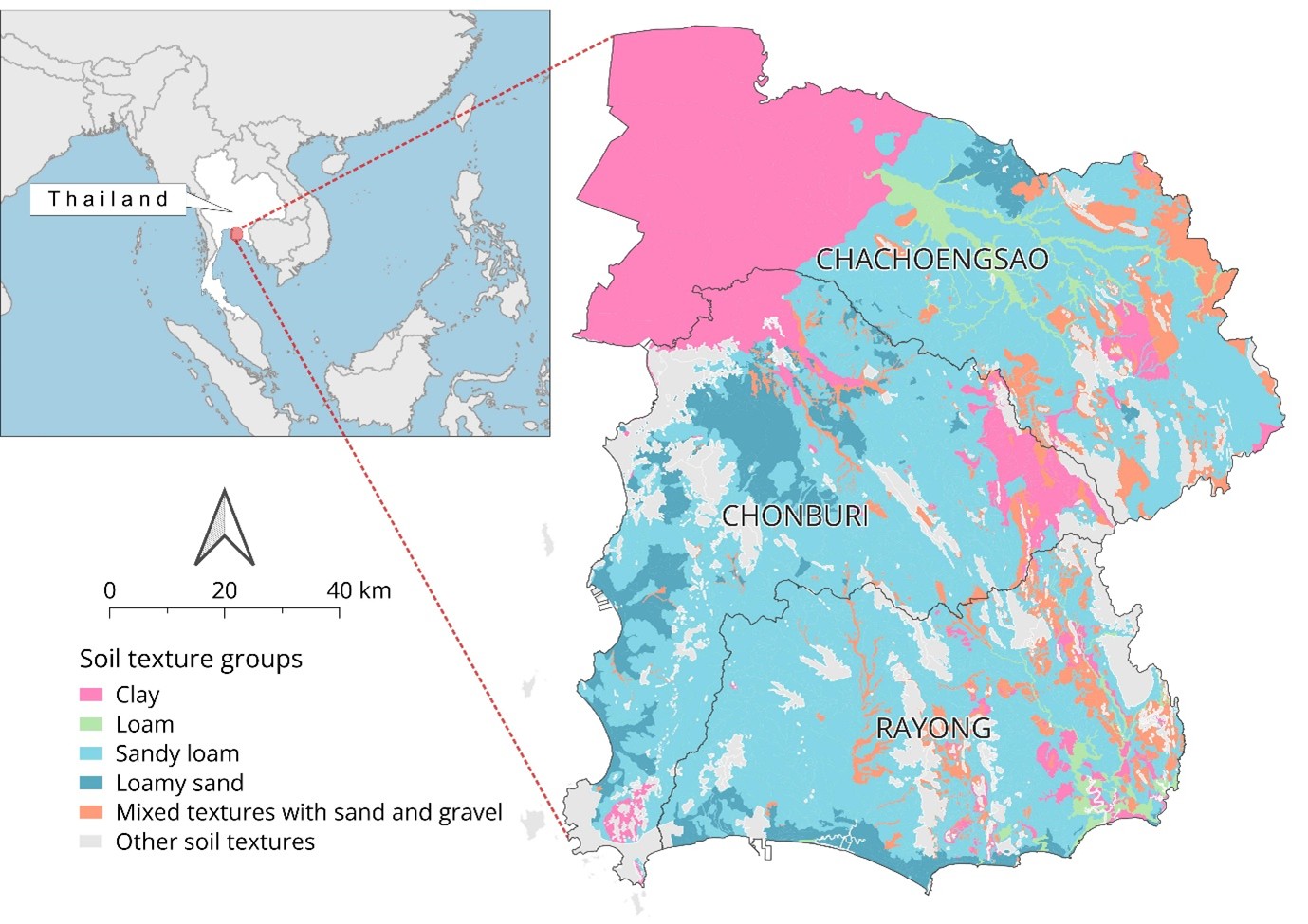
Three eastern provinces of Thailand and soil texture group distribution map.
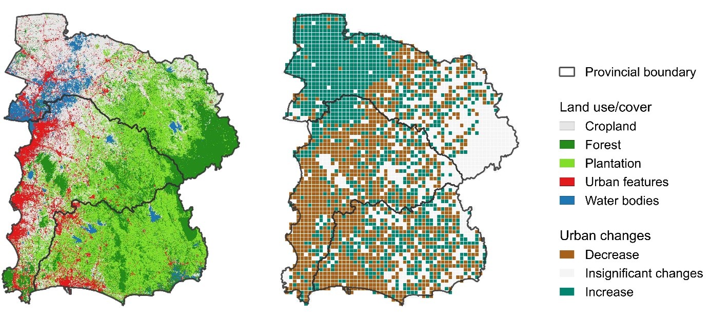
Predicted LULC map in 2040 under the LST alleviation scenario by considering soil textures in urban planning (left panel) and urban area changes compared to the BAU scenario (right panel).
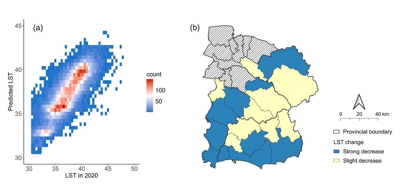
Surface temperature simulation, (a) density plot shows the relationship between LST and simulated LST (unit: °C), and (b) differences between simulated LST in 2040 under the alleviation and BAU scenarios.